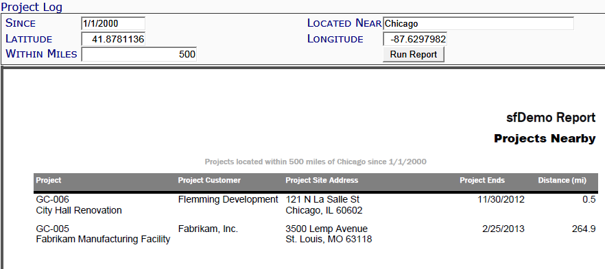
This report displays information about projects within a specified location or radius.
Note: although the image above does not show the Output drop-down, you can select an output method (PDF/Excel/CSV) for this report.
Filters
- Since – the project start date since when to include in the report.
- Located Near – a location entered as Project ID or anything else that Google Maps will accept as an address (e.g. ZIP code; Airport code; city, state, etc.) When you tab out, the Latitude and Longitude will be filled out automatically.
- Latitude – an exact latitude point.
- Longitude – an exact longitude point.
- Within Miles – the number of miles near the indicated location to be considered the radius for this report. You can enter decimals.
Columns
- Project – the ID and name of the project.
- Project Customer – the name of the customer of the project.
- Project Site Address – the site address of the project, as entered on the Project Setup document’s Addr tab.
- Project Ends – the Project’s end date.
Last updated: October 19, 2016 at 9:53 am;

